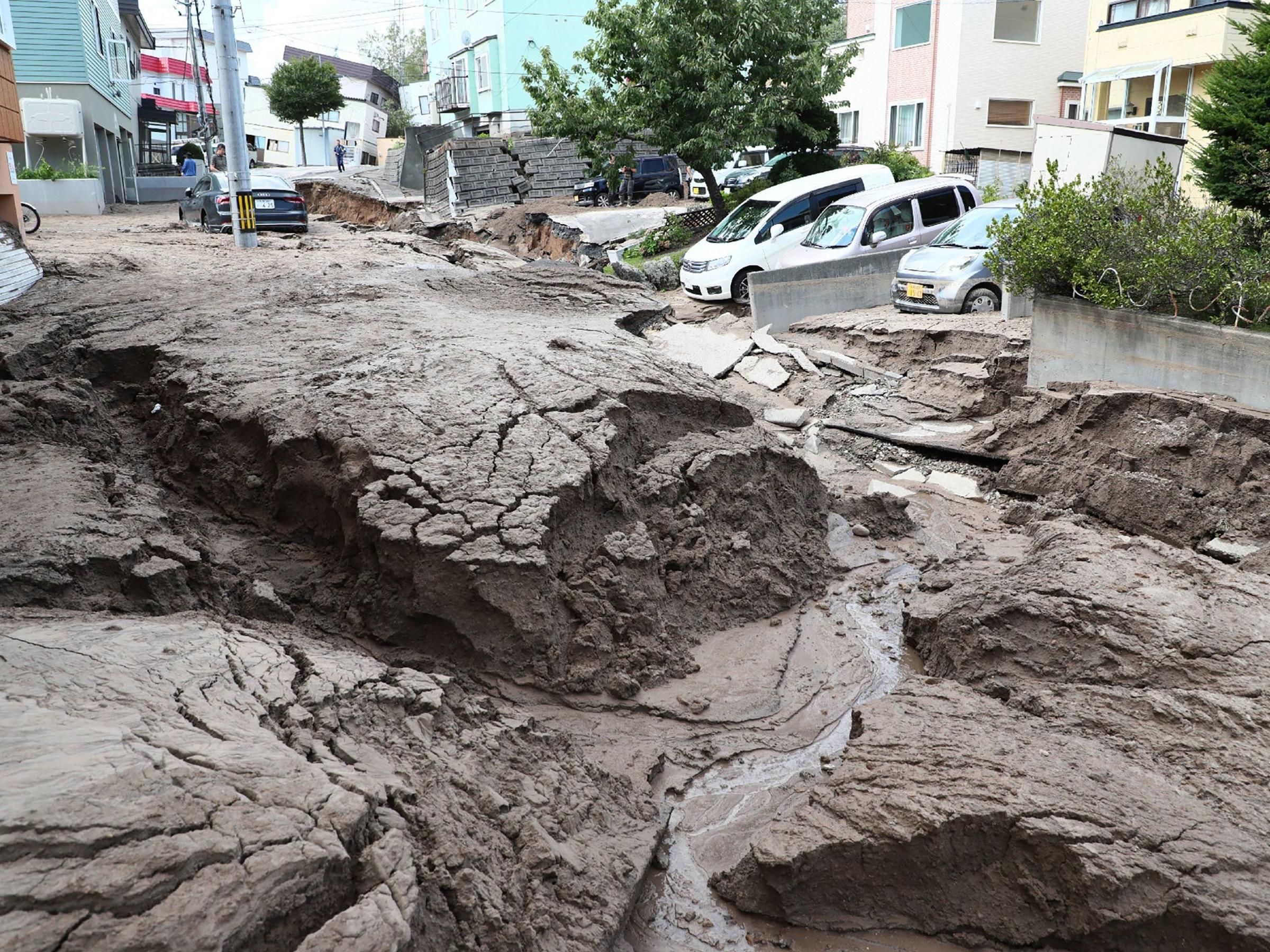
Japan’s Hokkaido Rattled by Magnitude 6.0 Earthquake

Japan’s Hokkaido Rattled by Magnitude 6.0 Earthquake
In the early hours of Friday, the Hokkaido region in Japan experienced a significant seismic event, with a magnitude of 6.0. This occurrence, documented by the German Research Centre for Geosciences (GFZ), underscores the region’s vulnerability to seismic activity and the potential consequences it can entail.
While a magnitude 6.0 earthquake can lead to varying degrees of impact depending on factors like local infrastructure and geological conditions, it serves as a reminder of the importance of disaster preparedness and response in seismically active areas. Japan, situated within the Pacific “Ring of Fire,” is no stranger to earthquakes, and its readiness measures play a crucial role in mitigating potential damages and ensuring the safety of its residents.
The seismic event that occurred in the Hokkaido region of Japan at 5.44 am local time has been documented by the German Research Centre for Geosciences (GFZ). This information provides crucial details about the timing and location of the earthquake, contributing to a comprehensive understanding of the event’s characteristics.

The earthquake’s depth, recorded at 46 kilometers, is another essential parameter that helps experts analyze the nature and potential impact of the seismic activity. Depth measurements offer insights into the geological layers where the earthquake originates, influencing the way it’s felt on the surface and the extent of its potential effects. These details are crucial for evaluating the potential consequences and for making informed decisions regarding safety measures and disaster management strategies in the affected region.
As of now, there have been no reported casualties resulting from the earthquake that struck the Hokkaido region of Japan. The absence of casualties is a relief in the face of such seismic events, as it reflects the effectiveness of preparedness measures and potentially lower levels of impact. However, further information is eagerly anticipated to provide a more comprehensive understanding of the situation, including any potential damages, disruptions, or other impacts that may have been incurred as a result of the earthquake. As details continue to emerge, authorities and concerned parties will be better equipped to assess the situation and respond accordingly.
Likewise, on Thursday, another seismic event occurred, this time in eastern Turkey, registering a magnitude of 5.2. This earthquake, as reported by the European Mediterranean Seismological Centre (EMSC), adds to the recent series of seismic activities around the world. The occurrence of earthquakes in different regions highlights the dynamic nature of tectonic activity and its potential consequences for local communities and infrastructure. While this earthquake’s magnitude is relatively moderate, its occurrence underscores the need for ongoing vigilance and preparedness in seismically active regions to minimize potential impacts and ensure the safety of residents.

The seismic event took place at a location 10 kilometers to the South South West (SSW) of Malatya, a city in Turkey. This event occurred precisely at 17:48 Coordinated Universal Time (UTC) on Thursday, as detailed by the European Mediterranean Seismological Centre (EMSC). The geographical and temporal specifics of the earthquake provide crucial information for understanding its origin and impact, aiding experts in their assessments and responses. Such data is essential for evaluating potential damages and for formulating appropriate measures to address the aftermath of the earthquake.
The earthquake’s depth was recorded at 10.9 kilometers. This measurement provides insights into the location within the Earth’s crust where the seismic activity originated. The depth of the earthquake is a critical factor that influences how the earthquake is felt on the surface and the potential extent of its impact on structures and communities. By understanding the depth of the earthquake, experts can better assess its potential consequences and develop appropriate response strategies.
Sharing information about the earthquake, the European Mediterranean Seismological Centre (EMSC) utilized its Twitter account to convey the details. In its tweet, EMSC provided a concise summary: “#Earthquake 10 km SW of #Malatya (#Turkey) 19 min ago (local time 20:48:00).” The tweet also included an updated map that utilized colored dots to indicate the reported local shaking and the level of damage as observed by eyewitnesses. By disseminating such information on social media, EMSC aims to keep the public informed about seismic events and their potential impact on the affected area. This transparent communication helps raise awareness and promote safety measures in the aftermath of earthquakes.


